Latest changes on emta.com
Identification of metropolitan area
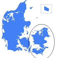
Movia is responsible for public bus and local train services in East Denmark, including the Copenhagen metropolitan area. This area comprises half the population of Denmark. Main figures : Metropolitan area Region Surface 2.559 km2 9.783 km2 Population 1.811.512 2.644.512 Employment 974.969 1.296.654 GDP/inh 61.300 € 52.600 € Map showing the region within the
Financing / Pricing data
Presentation of the fare and ticketing system : Table of local fares (simplified) 2016 Single trip center Multiple trips Monthly pass Normal fare 24 DKK 15 DKK 375 DKK Reduced fare Children, age 12-15 12 DKK 7,50 DKK 190 DKK Retired people, age >65 24 DKK 15
Public transport system
Description of the network Public transport appeared in the Hungarian capital city, Budapest, in the early 19th century in the form of the omnibus and later the horse tramway. These were followed by means of transport that were revolutionary in those times: Europe’s second funicular connected the Castle Hill with the Danube riverbank while the
Identification of metropolitan area
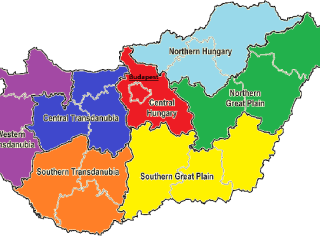
Budapest is the capital and the largest city of Hungary, which also means that it is the country’s principal political, cultural, commercial, industrial and transportation centre. Budapest became a single city occupying both banks of the river Danube with the unification in 1873 of west-bank Buda and Óbuda with east-bank Pest. Budapest has 1.74 million
Financing / Pricing data
Fares BKK is responsible for fares, scheduling, ticketing and revenue protection/ticket control. Presentation of the fare and ticketing system The existing local and suburban tariff systems are currently different from each other but steps have already been taken towards an integrated system. In parallel to the implementation of the Automatic Fare Collection system in Budapest,
Identification of the metropolitan area
The Bucharest-llfov region is the area with the highest population density in Romania, with a population of 2,272,163 inhabitants (according to the 2011 Census) and a density of 1,248 inhabitants per km². Bucharest has a total population of 1,883,425 inhabitants and a total area of 228 km², at a density of 8,260 inhabitants per km².
Public transport networks
Public Transport System Description of the network: Local company (STIB): underground tramways bus Regional companies: TEC (Walloon Region) and DE LIJN (Flemish Region): only bus Railways (SNCB): owned by federal State; 95% of passengers lines of SNCB goes trough Brussels Urban Buses Suburban buses Tramways Metro Heavy Rail Nb of lines 50 +/- 50
Identification of metropolitan area
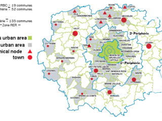
Brussels Capital Region is one of the three Belgian Regions. It is divided into 19 communes. It has about 1.2 million inhabitants, out of a total Belgian population of about 12 million. Brussels Capital Region is administered by a Parliament and a Regional Government composed of 89 elected members. Brussels Mobility is one of the
Public transport networks
Public Transport System Description of the network: In 2015/16, 325.8 million public transport journeys were made in the West Midlands Metropolitan Area (267.1 million bus passenger journeys, 53.7 million rail passenger journeys and 5.0 million metro passenger journeys). Bus: 96% of bus service kilometres in the West Midlands are operated on a commercial basis by
Identification of metropolitan area
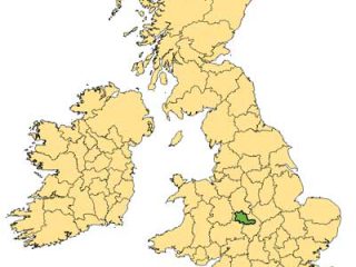
Description of metropolitan area The West Midlands is made up of seven Local Authority areas with a total population of 2.56 million inhabitants. These Local Authorities are: Birmingham, Coventry, Dudley, Sandwell, Solihull, Walsall and Wolverhampton.Birmingham is the largest of the Local Authority areas and is the second largest city in the United Kingdom. The West
EMTA Members